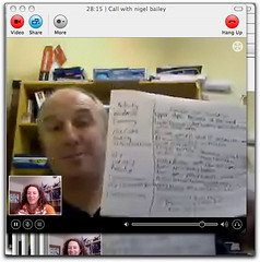
Nigel Bailey, originally from the UK where he used to tramp the hills of Derbyshire and the Lake District, was inspired by the landscape surrounding him to study and teach geography. Still a student himself, Nigel is a strong believer in lifelong learning and inquiry, and is currently studying a social networking/Web 2.0 paper with Canterbury.
To watch the video click here.
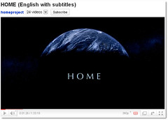
Nigel now teaches at Chanel College, Masterton (in the glorious Wairarapa), where he is contextualising and personalising geography in a way that helps make geography meaningful and enjoyable for his students. For example, Nigel has been using the video entitled 'Home' to spark interest and to start a lively conversation about the intensive farming of cattle in the US, which he finds leads naturally to an impassioned discussion amongst the students for whom cattle farming is a staple in the Wairarapa.
Acknowledging how tricky it can be for learners to shift into a research-focussed, applied way of learning Nigel uses a range of scaffolding strategies to empower them. For instance, he is trialling what he calls a 'light scaffolding' approach to sessions. As a result he is finding that students are becoming more engaged, and even the quieter ones are asking questions, with some students are coming to him at the end of a session to discuss things. When Nigel is not sure of the answer, or they have run out of time he encourages the student to look it up and come back to him...which he is finding they are doing, sometimes even turning up to a session early to share what they have found out.

Video conferencing (used in conjunction with a Moodle course Nigel has developed) opens up the world to students around New Zealand who are keen to study Level 3 geography but are not able to access a course where they are located. His current students are based in a variety of places such as Otaki, Cromwell, and Solway. As well as providing easily accessible, visually appealing content, Nigel has designed the Moodle course to offer a range of quizzes, resources and forums, and has even instigated a virtual chocolate fish initiative.
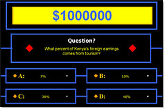
Nigel is a strong believer in his students having fun while learning. One of the things he enthused about was an exciting experience he recently had with students where he found a template of "Who wants to be a Millionaire" with all the sound effects (you can download a similar Powerpoint (with music - .zip file) and adapted it from maths questions to geography questions. He said that the students got into the experience wholeheartedly, and during the quiz got closer and closer to the board as the noise levels and excitement increased. As well as the energy in the room, Nigel also pointed out that there were some great discussions and explanations between the learners around the possible answers, which he felt encouraged the process of internalisation and externalisation really well.
Alongside the work he is doing with students, Nigel is an active participant in the Isolated to Connected Geographers' online community, especially around the subject of GIS (Geographic Information System) and the new standards. He recently became a member of the Isolated to Connected site,and when faced with difficulties around GIS he posted to the community for help, which he found invaluable.
He has been working with Google Earth, and has discovered that he can use layers that work similarly to the GIS concept. Nigel is hoping to target the local context of the Masterton by-pass to localise and contextualise, because he has found a lot of information around the initiative and it will be directly relevant to many of his students. If Nigel can create the scenario on Google Earth then he feels everyone will have access to it, and it would not be difficult to provide guidance for other teachers around how to use it. Ideally, Nigel would like to get of cluster of Wellington area geographers together to use Google Earth and the same procedure, but make it current and local to them. The community could be facilitated online, as could the upskilling and sharing sessions, and he has already started putting together a wiki space, Geobits (http://geobits.wikispaces.com/) to this end. The notions of viral and social networking and co-constructing, evolving knowledge are very much underpinning Nigel's initiative here and his projected outcomes. His hopes are that regional specialists would develop, and that a reciprocal arrangement could be reached to share specialists across clusters. This, in turn, could be facilitated by the development of an easily-accessible database of specialists and their specialisations, along with when/how they can be / are prepared to be contacted.


No comments:
Post a Comment